Just off the coast of Queensland are the three largest sand islands in the world. The largest is the world heritage listed Fraser Island, about 200 km north of Brisbane. The second largest is North Stradbroke Island, off Brisbane’s southern coast. Immediately north of North Stradbroke and forming the eastern boundary of Moreton Bay is Moreton Island. Moreton Island is the third largest of these.
On New Year’s Day we visited Moreton for perhaps the fourth time.
My love of this island started a few years ago when, while on our Christmas break, Paul, Matthew, Danielle, and I took a day trip to Moreton to go snorkelling on the Tangalooma wrecks.
Stretching nearly 40km long and about 9km across at its widest, the island is about 95% national park. Of this, I’ve only seen a very small portion, mostly the Tangalooma wrecks; 15 boats, dredges, and barges that were scuttled on the western side of the island over a couple of decades starting in 1963. The wrecks were intended to create a safe anchorage for small craft, but have also become an artificial reef that is home to beautiful tropical fish and corals.
Brisbane has had some inclement weather over this Christmas break, but we had chosen a perfect summer’s day for our Moreton Island day trip. We had left home at 6.30am in the midst of a summer cloudburst, wondering whether we had made the right decision. One suburb south of home the road was dry and our decision was vindicated. We boarded the ferry and took up position on the top deck for the 20-odd nautical mile, hour and a quarter steam to the island.
Paul, Rob, Cayla, Matt and I headed over to the island on the MiCat car ferry that leaves the Port of Brisbane and pulls up on the beach at the Tangalooma wrecks. After the dozen or so 4WDs drove onto the beach the pedestrians disembarked. We headed for the shaded area just off the beach, adjacent to where the ferry lands, and just behind the row of foreshore vegetation. While it is not absolute beachfront, it affords protection which, as the day wears on, becomes a premium under the Queensland sun. We were well kitted with a couple of beach shelters, trusty beach umbrella, folding chairs, eskies, snorkelling gear, sunscreen, and other beach necessities.
Base camp established we hit the water. I’m not a fan of the surf, but the water in the lee of the island is akin to the gentle North Queensland beaches where I grew up. It was mid-morning and the tide was halfway out resulting in a significant current heading north up the beach. We had donned our masks and flippers for the short swim to the wrecks, but the current made it hard work so we opted to wait until closer to the bottom of the tide.
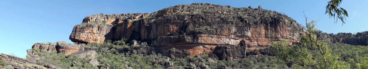
This left me with about an hour and a half to do one of my other favourite Moreton Island pursuits, scaling the sand dunes. The first dune north of the wrecks is about 50 metres high, and steep. Using the principle that approaching a slope on a diagonal reduces the gradient, I started at the southern end and made my way directly towards a clump of vegetation about halfway up on the northern boundary of the dune. I was wearing my trusty Indian sandals, a must because of the increased surface area they afforded on the steep, unstable sand, but mostly because of the escalating temperature as the pure white sand absorbed the heat from the baking summer sun.
Arriving at my target I decided it would be, perhaps not easier but, certainly quicker to take a more direct route, straight up the side of the dune, so I made my way up the last 25 metres climbing among the bushes and trees that cling tenaciously to the steep sandy slope. When I got to the top I was hot, sweaty, and a little bloody, but the spectacular view down to the wrecks and across Moreton Bay to the skyscrapers of the Brisbane CBD and the Glasshouse Mountains north of Brisbane was worth every huff and puff. The water was smooth and clear, turquoise in the shallows, dark blue in the deep of the bay. The sky was dotted with fluffy white and grey clouds that teamed with the sea breeze to moderate the temperature down here on the ground. The Glasshouse Mountains were clearly defined against the sky, and in stark contrast below them the white sandy beaches of the mainland north coast were a glistening ribbon between the blues of the mountains and the Pacific.
I descended the dune via the scrub on the southern side, stopping periodically to enjoy, and photograph, the view of the wrecks through the Banksia and other native scrub.
Chilled grapes make for a great snack, and an excellent source of hydration, and after a cooling break in the shade of our base camp, I headed for the beach. It was nearly midday, just over an hour from low tide, and time to test if the current had settled. The conditions were nearly perfect and while Rob and Cayla set up the beach shelter, Paul and I swam across the anchorage, weaving in and out of the moored boats, to the wrecks; the swim made much easier by the assistance of our flippers.
We snorkelled in among the ‘Morwong’ and ‘Maryborough’ suction dredges, and the ‘Stingaree’ and ‘Bream’ barges. A veritable forest of coral grows on the lower, protected surfaces that were once the decks, holds, and bollards of the boats. And every other submerged surface is covered with barnacles and short soft sea weeds. Against this backdrop a vivid array of small tropical fish, swim endlessly among the steel structures and corals.
We were surrounded by hundreds of small tropical fish, species too numerous for a novice like me to identify. But among them were pretty yellow “Bluespot Butterflyfish”, with a smudge of pale blue on their body and a dark spot on the tail; aptly named, strikingly yellow and black striped, “Stripey”; “Sargeant Major Damselfish” with their black and white stripes and yellow back; and darting in and out among them scores of other fluorescent blue and vividly yellow Damselfish; small black fish with yellow tails; and schools of small silver bait fish.
The fish seem well accustomed to the presence of snorkellers and their apparent curiosity, or perhaps even aggressiveness, had small fishes nudging me, just checking, I guess.
Visibility wasn’t great, not much more than a few metres, but we were still afforded a wonderful, calming experience among the artificial reef that has established itself over the past fifty years.
After an hour or so we headed back to the shore to hand the snorkel gear over to Rob and Cayla. They emerged from the water an hour later. It was Cayla’s first time snorkelling and, like the rest of us, she enjoyed the experience immensely.
The afternoon breeze was picking up, as was the current with the turn of the tide, but that didn’t deter Matthew who donned flippers, after a rejuvenating ‘kindy’ nap in the shade of the trees (the young have no staying power), and took to the wrecks. Like his father, with Go-pro in hand, he chronicled his experience of the wrecks.
I rounded off my Moreton Island experience with a walk along the beach, photographing groups of starfish that wallowed in the shallows; they were tossed around by the lapping waves. Occasionally I righted one that had been turned upside down in the gentle shore swell.
Our ferry departed at 4.30pm, and we relaxed again on the upper deck for our journey back across Moreton Bay.
Our excursion to Moreton Island was a perfect start to 2015, setting the benchmark for the rest of the year; it will have to be a very good year to top day one!
Click here to see some piccies from our snorkelling on the wrecks


